The shop is temporarily unavailable right now. Please try again in a moment.

N 50.7359°E 15.7395°↑ 1,603 mNo. 014

Adventures, just as you lived them.

From the map into your hands.

Pick a place or upload your route. From precise elevation data we make 3D-printed reliefs. Laser-cut contours, layered city maps and scratch holograms are on their way.

Trail.Love.Story 3D-printed relief on a wooden stand on a desk next to a route map

01 — Idea

A memory has coordinates.

A photo shows what a place looked like. A relief shows what it was like: how far you climbed, where the trail turned, where the view opened up. From precise elevation data and your route we make an object that keeps telling your story.

  1. Place

    The Earth’s real topography. No illustration, no template.

  2. Story

    Your route, your summit, the landscape you love.

  3. Shape

    Layer by layer, with precise modern technology.

  4. Object

    Signed by its place, with a Birth Certificate and a Certificate of Authenticity.

02 — How it’s made

From place to object.

Seven steps from a real landscape to an object that fits in your palm. The sample route is an indicative climb from Pec pod Sněžkou through the Obří důl valley to Sněžka.

  1. Step 1 / 7

    A landscape from precise data

    The map rises into real terrain. An elevation model accurate to ±3 m captures every ridge and valley. This is Sněžka, 1,603 m, with the Obří důl valley below.

    N 50.7359° · E 15.7395° · ↑ 1,603 m

  2. Step 2 / 7

    Your path in the terrain

    Upload a GPX track or pick a summit, and the route becomes part of the relief. Here: an indicative climb from Pec pod Sněžkou through Obří důl to the summit.

    indicative route · Pec pod Sněžkou → Sněžka

  3. Step 3 / 7

    Shape is made of layers

    We break every shape into layers. The technology sets their thickness: millimetre boards along the contours for the laser, fractions of a millimetre for 3D printing.

    laser: one board per contour · 3D printing: 0.12 mm layers

  4. Step 4 / 7 Coming soon

    Laser: cut along the contours

    A precise laser cuts each contour from its own board, and we stack the boards. The result is a terraced relief with crisp edges and the dark rim the cut leaves behind.

    board by board, along the contours

  5. Step 5 / 7

    3D printing: layer by layer

    Modern 3D printing builds the relief a fraction of a millimetre at a time, from corn-based bioplastic. The route is printed in its own colour, so it is part of the relief, not a sticker on top.

    0.12 mm layers · corn-based bioplastic

  6. Step 6 / 7

    Signed by the place

    The laser engraves the name, coordinates and piece number into a rubberwood stand. We then finish the wood with natural oils.

    TRAIL.LOVE.STORY · No. 014

  7. Step 7 / 7

    Ready within 14 days

    Your finished object comes with a Birth Certificate and a Certificate of Authenticity. Every piece is made to order, and production takes no more than 14 days.

    14 days · Birth Certificate · Certificate of Authenticity

    Design your own →

After production

14days of production, every piece made to order
±3 mtopography accuracy
Bioplasticcorn-based, on a rubberwood stand finished with natural oils
Originalevery piece has a Birth Certificate and a Certificate of Authenticity

03 — Collection

Trail.Love.Story.

Limited edition 2026. Your own design, your GPX route or one of our ready-made models.

Edition
S·26·Q3
Model
corn-based bioplastic
Stand
rubberwood, natural oils
Documents
Birth Certificate, Certificate of Authenticity
View the collection →
Trail.Love.Story relief on a wooden stand next to a route map
Trail.Love.Story · on a desk
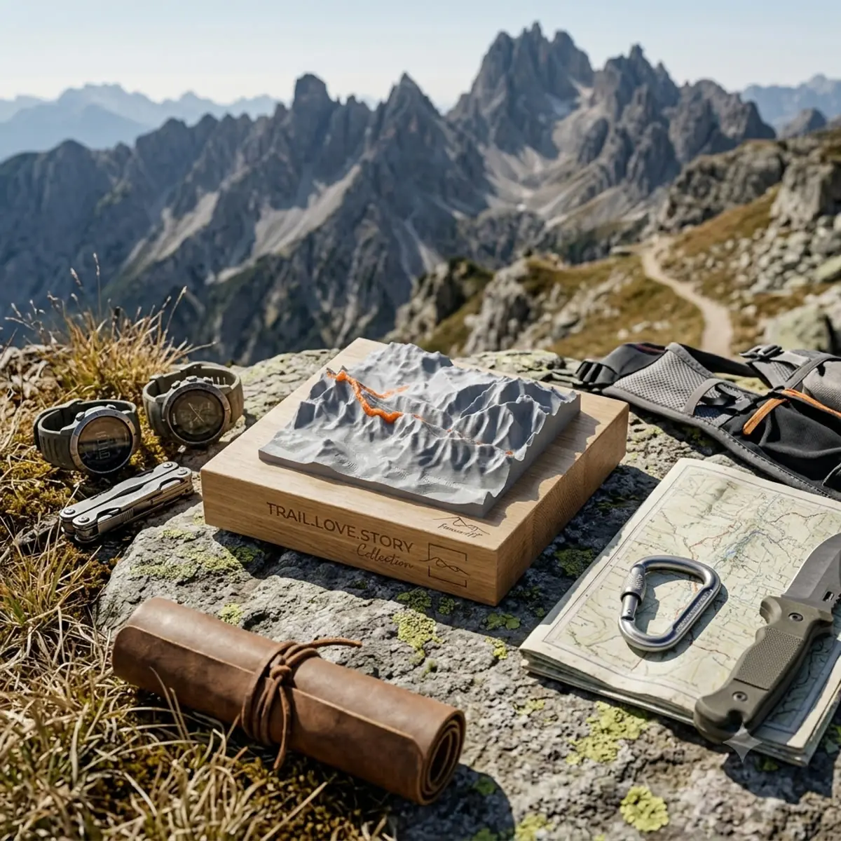
Trail.Love.Story relief on a rock in the mountains
Trail.Love.Story · in the mountains

04 — Bespoke

Choose your place on the planet.

From the ridges of the Jeseníky Mountains across the Alpine peaks, all the way to the crests of the Himalayas. If a place has elevation, it turns into a monument in your room.